
Mahmoud Ahmadinejad
Alliance of builders
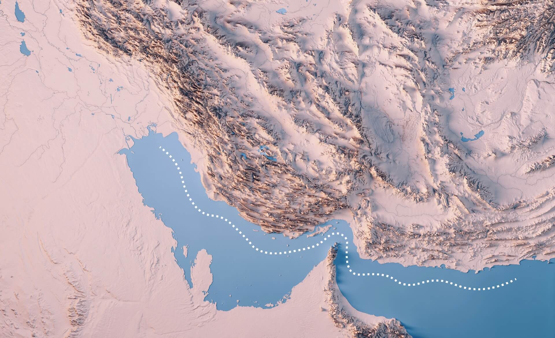
Iran has two separate coastlines. To the north, it borders the Caspian Sea, and to the south, it faces the Gulf. Its southern waters include more than 30 islands, several of which lie along the Strait of Hormuz and form a defensive arc.
Ranked 17th by land area and population, Iran has about 92 million people and is roughly the same size as the US state of Alaska.
Stretching some 1,800km (1,120 miles), Iran’s southern coastline forms a vast maritime corridor from the marshy Iraqi delta in the west to Pakistan’s rugged terrain in the east.
At its centre lies the Strait of Hormuz, a narrow chokepoint through which 20 percent of global oil and gas flows.
Scattered along this coastline are several islands that host military outposts, energy hubs, and geopolitical leverage points within what analysts describe as Iran’s “strategic architecture” of control.
The Strait of Hormuz is one of the world’s most critical oil chokepoints and serves as the sole maritime exit for one-fifth of the global oil and liquefied natural gas supplies.
Although the strait is only 39km (21 nautical miles) at its narrowest, the actual deep-water lanes required for massive tankers and cargo ships are concentrated in a very small area.
To manage these vessels, the strait is divided into two main shipping lanes, each approximately 3.7km (2 nautical miles) wide, separated by a buffer zone.
 interactive.aljazeera.com
Ranked 17th by land area and population, Iran has about 92 million people and is roughly the same size as the US state of Alaska.
Stretching some 1,800km (1,120 miles), Iran’s southern coastline forms a vast maritime corridor from the marshy Iraqi delta in the west to Pakistan’s rugged terrain in the east.
At its centre lies the Strait of Hormuz, a narrow chokepoint through which 20 percent of global oil and gas flows.
Scattered along this coastline are several islands that host military outposts, energy hubs, and geopolitical leverage points within what analysts describe as Iran’s “strategic architecture” of control.
The Strait of Hormuz is one of the world’s most critical oil chokepoints and serves as the sole maritime exit for one-fifth of the global oil and liquefied natural gas supplies.
Although the strait is only 39km (21 nautical miles) at its narrowest, the actual deep-water lanes required for massive tankers and cargo ships are concentrated in a very small area.
To manage these vessels, the strait is divided into two main shipping lanes, each approximately 3.7km (2 nautical miles) wide, separated by a buffer zone.
A visual guide to Iran's coastline and strategic islands
From the Strait of Hormuz to Kharg Island, Al Jazeera tours 10 key islands, ports and energy hubs shaping Gulf trade.