The Treaty of Guadalupe Hidalgo (Tratado de Guadalupe Hidalgo in Spanish), officially
titled the Treaty of Peace, Friendship, Limits and Settlement between the
United States of America and the Mexican Republic,[1] is the peace
treaty signed on February 2, 1848, in the Villa de Guadalupe Hidalgo
(now a neighborhood of Mexico City) between the United States and
Mexico that ended the Mexican–American War (1846–1848).
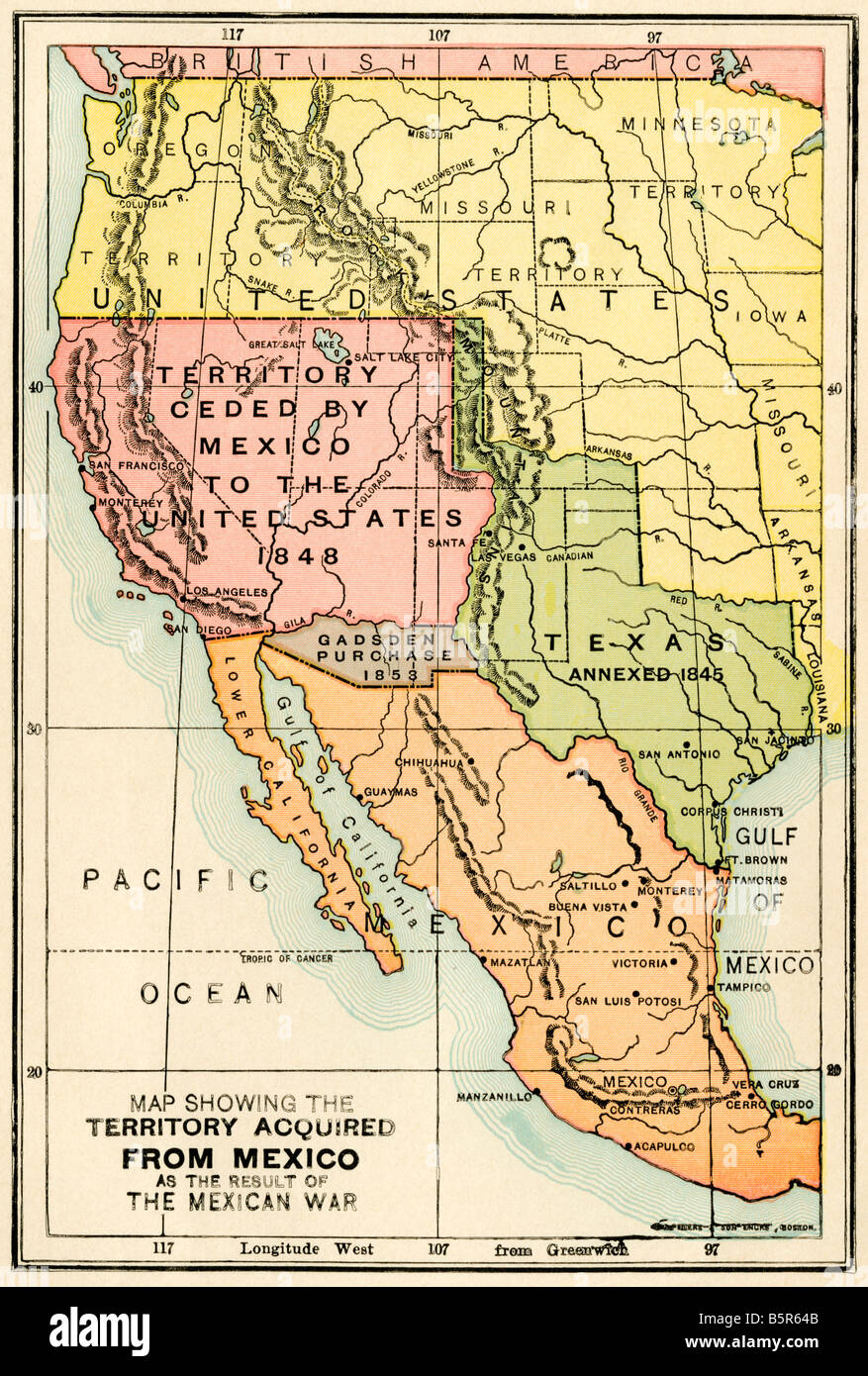
Although Mexico ceded Alta California and Santa Fe de Nuevo México, the text of the treaty[4] did not list territories to be ceded, and avoided the disputed issues that were causes of war: the validity of the 1836 secession of the Republic of Texas, Texas's unenforced boundary claims as far as the Rio Grande, and the 1845 annexation of Texas by the United States.
Instead, Article V of the treaty simply described the new U.S.–Mexico border. From east to west, the border consisted of the Rio Grande northwest from its mouth to the point where it strikes the southern boundary of New Mexico (roughly 32 degrees north), as shown in the Disturnell map, then due west from this point to the 110th meridian west, then north along the 110th Meridian to the Gila River and down the river to its mouth. Unlike the New Mexico segment of the boundary, which depended partly on unknown geography, "in order to preclude all difficulty in tracing upon the ground the limit separating Upper from Lower California", a straight line was drawn from the mouth of the Gila to one marine league south of the southernmost point of the port of San Diego, slightly north of the previous Mexican provincial boundary at Playas de Rosarito.
Comparing the boundary in the Adams–Onís Treaty to the Guadalupe Hidalgo boundary, Mexico conceded about 55% of its pre-war, pre-Texas territorial claims[5] and now has an area of 1,972,550 km² (761,606 sq mi).
In the United States, the 1.36 million km² (525,000 square miles) of the area between the Adams-Onis and Guadalupe Hidalgo boundaries outside the 1,007,935 km2 (389,166 sq mi) claimed by the Republic of Texas is known as the Mexican Cession. That is to say, the Mexican Cession is construed not to include any territory east of the Rio Grande, while the territorial claims of the Republic of Texas included no territory west of the Rio Grande. The Mexican Cession included essentially the entirety of the former Mexican territory of Alta California, but only the western portion of Santa Fe de Nuevo Mexico, and includes all of present-day California, Nevada and Utah, most of Arizona, and western portions of New Mexico and Colorado.

 Hare Krishna Templar
Originally Posted by bhaktajan

 Posting Rules


 Reply With Quote
Bookmarks